MAPS & MAPMAKERS
059 Maps & Mapmakers -Toscanelli´s Map (modern version of)
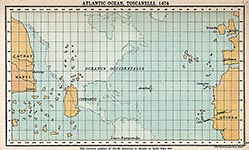 1. "The Florentine mathematician, astronomer and cosmographer Paolo dal Pozzo Toscanelli (1397-1482) is probably best remembered for his proposal in 1474 to the Portuguese court of a scheme to sail west as a shortcut to reach the fabled Spice Islands in the east. Toscanelli never made it across the ocean, but his proposal did inspire Columbus, who took Toscanelli´s map with him on his first transatlantic voyage in 1492. The Genoese navigator was not only inspired, but also misguided by Toscanelli´s underestimation of the earth´s circumference, leading him to think he had reached Cipangu (Japan) instead of a whole new, unknown continent lying in between Europe and Asia.
The eastern part of Toscanellli´s map, showing the extreme west of Europe and northwest of Africa, is quite accurate, even if the size of the land masses is exaggerated (in relation to the ghostly projection of the Americas); Portuguese mariners had travelled quite far south along the coast of Africa, and knew about the Azores (rediscovered in 1427). The Canary Islands were conquered by the Castilians from 1402 onwards. Nevertheless, many of the islands pictured here in the western Atlantic Ocean are quite clearly some of the many phantom islands that for a long time were recorded on maps, but were never more than legends. One such example is Hy-Brasil, probably one of the islands pictured closest to Ireland.
Another phantom island, mentioned on this map, is Antillia, also known as the Island of Seven Cities or St Brendan´s Island (ref. 073), and often used as a synonym for the Isles of the Blessed or the Fortunate Islands. The muddled legends of Antillia have been around since at least Plutarch´s time (ca. 74 AD). Its name might be a corruption of Atlantis; or a derivation of anterioris insula, Latin for an island located ´before´ Cipangu; or a transformation of Jazeerat at-Tennyn, Arabic for ´Island of the Dragon´. Toscanelli on his map uses Antillia as the main marker for measuring distance between Portugal and Chipangu."
this text: © 2014, Frank Jacobs, The Big Think, Inc.
2. A modern version of Toscanelli's map. The Americas are depicted in light blue.
"Map of the Atlantic Ocean according to Paolo dal Pozzo Toscanelli (1474) Date: 1884. Source: "A literary and historical atlas of America, by J.G. Bartholomew"
In 1474 Toscanelli sent a letter and a map to his Port, ues, correspondent Fernão Martins, priest at the Lisbon Cathedral, detailing a scheme for sailing westwards to reach the Spice Islands and Asia. Fernão Martins delivered his letter to the King Afonso V of Portugal, in his court of Lisbon. The original of this letter was lost, but its existence is known through Toscanelli himself, who later transcribed it along with the map and sent it to Christopher Columbus, who carried them with him during his first voyage to the new world. Toscanelli had miscalculated the size of the earth which resulted in Columbus not realizing initially he had found a new continent."
©: this text :Wikipedia
see also: Who discoverd America on Pinterest
read more
© map: Public Domain
tags: #toscanelli #map #columbus
059a Maps & Mapmakers -Columbus Map
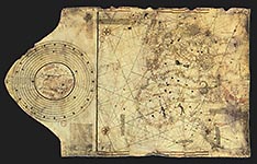 Christopher Colombus map. Lisbon, workshop of Bartolomeo and Christopher Colombus, c.1490. This map cannot be definitely linked to Columbus.
©: PD circa 1490, Source Bibliothèque Nationale de France (CPL GE AA 562 RES)
tags: #map #Columbus #
059b Maps & Mapmakers -Genoese World Map
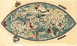 "The Genoese map is a 1457 world map. The map relied extensively on the account of the traveler to Asia Niccolo da Conti, rather than the usual source of Marco Polo. The author is not known, but is a more modern development than the Fra Mauro world map, with fairly good proportions given to each continents. The map also depicts a three-masted European ship in the Indian Ocean, something which had not occurred yet at the time."
Wikipedia
Link with extensive information: cartographic-images.net
©: Public Domain
tags: #Genoese World Map #Niccolo da Conti
059c Maps & Mapmakers -Piri Reis map
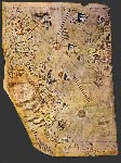 The Piri Re'is map was found in 1929 in the Imperial Palace in Constantinople. It is painted on parchment and dated 919 A.H. (in the Islamic calendar), which corresponds to 1513 AD. It is signed by an admiral of the Turkish Navy named Piri Ibn Haji Memmed, also known as Piri Re'is. According to Piri Re'is, the map had been assembled from a set of 20 maps drawn in the time of Alexander the Great.
read more: Piri Re'is map
A very interesting index explaining the Piri Re'is map
[From "The Oldest Map of America," by Professor Dr. Afet Inan. Ankara, 1954, pp. 28-34.]
Surviving fragment of the Piri Reis map showing Cent, l and South America shores. In his notes appended to it is written "the map of the western lands drawn by Columbus".
en.wikipedia.org/wiki/Piri_Reis_map
"The Piri Re'is Map is only one of several anomalous maps drawn in the 15th Century and earlier which appear to represent better information about the shape of the continents than should have been known at the time. Furthermore, this information appears to have been obtained at some distant time in the past."
www.sacred-texts.com/Piri-Reis/The Piri Re'is Map.htm
©: reproduction and more info on: Wikipedia
tags: #Columbus #Piri Reis map
059d Maps & Mapmakers -Martellus map
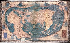 The Martellus Map (pictured brightened) which was created, n 1491 and is said to have been used by Christopher Columbus to navigate the Atlantic, has started to reveal its secrets because faded passages and locations have started to be deciphered by scientists
"The Martellus Map was created in 1491 by German cartographer Henricus Martellus. It's said that Columbus used this map or one like it to persuade Ferdinand of Aragon and Isabella of Castile to support him in the early 1490s. The map was made by a German cartographer living in Florence and reflects the latest theories about the form of the world and the most accurate ways of portraying it on a flat surface.It seemed to prove that, as Columbus argued, there wasn't a great distance between Europe and China by sea. The map is also the first to record the rounding of the Cape of Good Hope in South Africa by the Portuguese in 1488. This proved that there wasn't a land link to Asia in the south - and that Europeans could reach the riches of the East Indies by sea without having to go through Muslim-held lands."
Read more: www.dailymail.co.uk
See also:: www.latinamericanstudies.org
©: PD
tags: #Martellus Map #Columbus
ref. # 059e Maps & Mapmakers - Early Venetian Sailing Directions
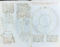 Drawings of zodiacs, hands, and divisions of time in Nicolo Stolfo. 'Early Venetian Sailing Directions in the Mediterranean Sea' Manuscript Venice, August 1499. © Rare Book and Special Collections Division, Library of Congress
"By the late fifteenth century an emerging body of literature to facilitate sea travel in the Mediterranean world was available. This early book of sailing directions served as a handy guide for the sailor and a storehouse of practical information for laymen. The use of the hand and zodiac for information was considered vital to the 15th century Mediterranean navigator".
© text & picture: www.ibiblio.org
tags: #Venice #navigation #sailing direction
059f Maps & Mapmakers -NASA picture of the Caribbean
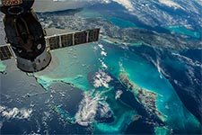 The Caribbean photographed from the International Space Station. Just imagine the face of Columbus when he could have seen this .. (Cuba - top, Andros Island bottom)
©: NASA
tags: #NASA #Caribbean #ISS #International Space Station
059g Maps & Mapmakers --another Piri reis map
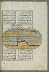 Creator: Piri Reis (Turkish, 1465-1555) (Author), Period: late 11th century AH/AD 17th century-early 12th century AH/AD 18th century (Ottoman), Medium: ink and pigments on laid European paper, Measurements: H: 13 3/8 x W: 9 7/16 in. (34 x 24 cm), place of origin: Turkey
please also download the complete map: pdf, with many magnificient maps and artwork.
"Originally composed in 932 AH/AD 1525 and dedicated to Sultan Süleyman I ("The Magnificent"), this great work by Piri REIS (d. 962 AH/AD 1555) on navigation was later revised and expanded. Walters manuscript W.658, made mostly in the late 11th century AH/AD 17th, is based on the later expanded version and has some 240 exquisitely executed maps and portolan charts. They include a world map (fol. 41a) with the outline of the Americas, as well as maps of coastlines (bays, capes, peninsulas), islands, mountains, and cities of the Mediterranean basin and the Black Sea. The work starts with the description of the coastline of Anatolia and the islands of the Aegean Sea, the Peloponnese peninsula, and the eastern and western coasts of the Adriatic Sea. It then proceeds to describe the western shores of Italy, southern France, Spain, North Africa, Palestine, Israel, Lebanon, Syria, western Anatolia, various islands north of Crete, the Sea of Marmara, Bosporus, and the Black Sea. It ends with a map of the shores of the Caspian Sea (fol. 374a). 9/12/2013"
©: CC and The Walters Art Museum
tags: #Piri Reis #the Walters Art Museum
ref. # 059h Maps & Mapmakers - Piri Reis
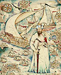 Taner ALAKUŞ 'Piri REIS'. His name means Captain Piri. He is known as the person who has drawn the Piri Reis Map. His full name was 'Haci Ahmed Muhiddin Piri'. Piri REIS is the author of the Kitab-i Bahriye, one of the most famous pre-modern books of navigation, including a world map.
more on Piri Reis here: www.katryngauci.com and here: www.crystalinks.com
©: Taner Alakuş, www.taneralakus.com
tags: #Piri Reis #Taner Alakus
059i Maps & Mapmakers -de Virga's World Map
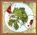 "This map by the Venetian cartographer, Albertin de VIRGA, shows Marco Polo's 'Southern Continent' southeast of Asia. The island-continent is called 'Ca-paru or Great India'. The map was made between 1410 and 1414. It was not until more than a century later that Francisco Pizarro, a Spaniard, finally reached Peru. He arrived at the shores of a southern mainland that was already named 'Peru'. And it was already included on Chinese, Venetian, and Portuguese maps. Western historians have given Pizarro credit for discovering Peru -even though it was already discovered and mapped by somebody else."
From a theory by Gunnar Thompson
©: cartographic-images.net
tags: #map; #mapmaker; #Albertin de Virga; #
059j Maps & Mapmakers -'Liu Gang Map'
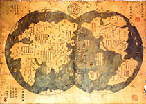 "Moreover, some of the errors in the 1418 map so, turned u, in Europe, maps, the most striking being California drawn as an island. The Portuguese are aware of a world map drawn before 1420 by a cartographer named Albertin di Virga, which showed Africa and the Americas. Since no Portuguese seamen had yet discovered those places, the most obvious source for the information seems to be European copies of Chinese maps."
"A map that purports to show Chinese mariners discovered the New World before Christopher Columbus could be genuine, university scientists in New Zealand said yesterday." www.chinadaily.com.cn
©: www.chengho.org
Index of maps relating to Gavin Menzies presentation in Beijing, March 22nd 2006 www.gavinmenzies.net
tags: #map; #mapmaker; #Liu Gang; #Gavin Menzies
059k Maps & Mapmakers -'Hendon Harris World Map 5'
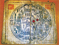 "Few people expect ever to own documents that could change world history," Harris writes in her 2008 book, Secret Maps of the Ancient World, "and neither did we. Yet for decades, under my brother's bed, lay ancient Asian maps that we, our father's seven children, inherited from him. Some believe that they may contain a secret of the ancient world."
"Q: People who read your book, your father's book and Gavin Menzies' book can easily be overwhelmed by all of the evidence you cite. But critics contend most of it is circumstantial. Of everything you've seen and learned about, what has been the most convincing evidence for you? A: DNA evidence, which is quite recent. We've known for a long time that the 'Chinese blue spot', which appears on the buttocks of babies and then disappears, is also seen at birth in many Native American communities. Now we know that five distinct genetic markers match ancient Chinese with modern Native Americans. That's evidence that you can take to court and win."
©: www.chinadaily.com.cn
tags: #map; #mapmaker; #Hendon Harris; #
059l Maps & Mapmakers -Waldseemüller map of 1507
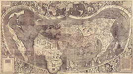 Universalis cosmographia secundum Ptholomaei traditionem et Americi Vespucii alioru[m]que lustrationes.
Title: Universalis cosmographia secundum Ptholomaei traditionem et Americi Vespucii alioru[m]que lustrationes.
Other Title: Universalis cosmographia secundum Ptholomaei traditionem et Americi Vespucii alioru que lustrationes
Contributor Names: WALDSEEMÜLLER, Martin, 1470-1519.
Created / Published: Strasbourg, France? : s.n., (1507)
Notes:
- Relief shown pictorially.
- First document known to name America.
- Red ink grid on 2 sheets. Text applied over blank areas on 2 sheets. Manuscript annotations in the margin of 1 sheet.
- All sheets bear a watermark of a triple pointed crown.
- Two stamps on verso of upper left hand sheet: Fürstl. Waldburg Wolfegg'sches Kupferstichkabinett -- Furstl. Waldbg. Wolf. Bibliothek.
- Exhibited: Rivers, edens, empires: Lewis & Clark and the revealing of America, Library of Congress, Washington, D.C., July 24-Nov. 29, 2003.
- LC digital image is a composite map from the twelve separate sheets.
- Originally bound with Waldseemüller's 1516 Carta marina in the Schöner Sammelband.
Medium: 1 map on 12 sheets ; 128 x 233 cm., sheets 46 x 63 cm. or smaller.
Call Number/Physical Location: G3200 1507 .W3
Repository: Library of Congress Geography and Map Di, sion Wash, gton, D.C. 20540-4650 USA dcu
Digital Id: http://hdl.loc.gov/loc.gmd/g3200.ct000725C, http://hdl.loc.gov/loc.gmd/g3200.ct000725
Library of Congress Control Number: 2003626426
Acquired for: US$ 10.000.000,00
©: LCCN Permalink: LOC
tags: #map; #mapmaker; #LOC; #Waldseemueller
ref. # 160 -Age of Discovery 1340 - 1600
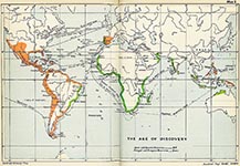 Discoveries of Spain and Portugal from 1340 - 1600
source: photobucket.com
tags: #discoveries #spain #portugal
ref. # 160a , -Exploration of the New World
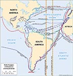 Map depicting the European exploration of the New World in the 15th and 16th centuries, including the voyages made by Christopher Columbus, John Cabot, Alonso de Ojeda and Amerigo Vespucci, Pedro Àlvares Cabral, Ferdinand Magellan and Juan Sebastiàn del Cano, Giovanni da Verrazzano, Jacques Cartier, Sir Francis Drake, and others. The lines of demarcation represent an early division between the territory of Spain (to the west) and Portugal (to the east).
©: Encyclopædia Britannica, Inc.
tags: #exploration #discovery #new world
ref. # 160b -Portuguese Empire by Marcos Ceia
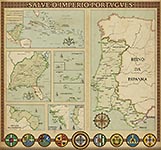 ©: Marcos Ceia: deviantart.net
tags: #Portuguese Empire
213 2014 travel journal -Nova Reperta
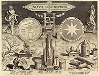 Nova Reperta Frontispiece
©: Creative Commons
Nova Reperta Frontispiece
©: Creative Commonstags: #Nova Reperta #Frontispiece
ref. # 213a 2014 travel journal -Map of Brazil, by Luiz Teixeira, ca. 1586
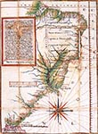 Note the Portuguese captaincies, or land grants to loya, nobles,, long th, Brazi, an coast. Of the first 15 charters, five were not colonized, 8 were of limited success due to Indian attacks, and only two of these - São Vicente and Pernambuco - were successful right away.
Map reproduced by David Woodward (editor), The History of Cartography, Volume 3: Cartography in the European Renaissance, 2007
via:urbangeographies.tumblr.com
tags: Map of Brazil, by Luiz Teixeira, ca. 1586
ref. # 213b 2014 travel journal -the Miller Atlas
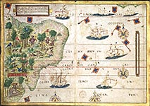 the Miller atlas 1519
(image: Lopo Homem, Pedro Reinel, Jorge Reinel, Antònio de Holanda)
via:visualoop.com/blog/23720/vintage-infodesign-85
tags: #the Miller Atlas
219 2015 travel journal -Sint Maarten
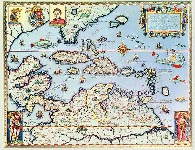 Map of the Caribbean Islands and the American State of Florida by Theodore de Bry
©: Public Domain
tags: #Caribbean map #Theodore de #Bry
219a 2015 travel journal - map Theodore de Bry
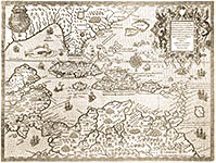 map Theodore de Bry
©: PD
tags: #Sint Maarten #cariben #map #Theodore de #Bry
more about Theodore de bry at Pinterest
139ASTRONOMY -'the Argonauts'
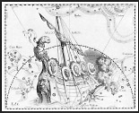 The Argo Navis constellation from Uranographia by Johannes HEVELIUS. The view is mirrored following the tradition of celestial globes, showing the celestial sphere in a view from "outside".
Date: 1690, Source: 'Atlas Coelestis'. Johannes Hevelius drew the constellation in 'Uranographia', his celestial catalogue in 1690. Author: Johannes Hevelius, ©: Wikipedia
tags: #Argonauts #Johannes Hevelius
Piri Reis
Mapmakers are writers too. Instead of words they use lines and keys and toponyms and symbolic codes. Sometimes to copyright their work they will incorporate a non-existent place or road into their map and use this as a safeguard against plagiarism. For the most part, maps leave no room for footnotes nor the acknowledgement of sources, and yet the mapmaker must have called upon a host of sources—hidden and acknowledged—for his map. How can we identify sources of influence when the mapmaker in question lived in the late fifteenth and early sixteenth-century and left behind only a vague hint of his sources?
quotation from: 'Searchin’ his eyes, lookin’ for traces: Piri Reis’ World Map of 1513 & its Islamic Iconographic Connections' (A Reading Through Bağdat 334 and Proust)
written by Karen PINTO
Read full .pdf here: www.academia.edu/resource/work/10262335

Istanbul, Topkapı Saray ı Kütüphanesi [TKS], Revan 1663m: Piri Reis World Map of 1513 (919 AH), Parchment, 90 x63 cm; courtesy of the Topkapı Saray ı Kütüphanesi.
LINK: folder about 'Maps & Mapmakers' on Pinterest
tags: maps, mapmakers, piri reis,
Atlas, designed to illustrate The geography of the heavens, comprising the following maps.
1. The visible heavens in October, November and December.
2. The visible heavens in January, February and March.
3. The visible heavens in April, May and June.
4. The visible heavens in July, August and September.
5. The visible heavens in the north polar regions for each month in the year.
6. The visible heavens in the south polar regions for each month in the year.
7. Planisphere of the whole heavens on Mercator's projection.
Author: Elijah H Burritt; Francis Junius Huntington; Illman & Co.,; Illman & Pilbrow,
Publisher: Hartford: : Published by F.J. Huntington., 1833.
Edition/Format: Map : Atlas : English View all editions and formats Database: WorldCat tags: Astronomy. --- tumblr_lhwkiqC8tX1qgaclmo1_250 = from: Square America Snapshots & Vernacular Photography --- ---
