Japan & Macao
'16TH Century Japan and Macau described by Francesco CARLETTI' (1573?-1636)
Bulletin of Portuguese - Japanese Studies, vol. 17, 2008, pp. 113-144
ISSN: 0874-8438 (bpjs.cham@fcsh.unl.pt)
Universidade Nova de Lisboa, Portugal
by Elisabetta COLLA
"This paper gives a brief account on Macau and Nagasaki at the end of 1590s as described by the Florentine Merchant Francesco Carletti in his Codex 1331 (T.3.22) preserved in the Biblioteca Angelica in Rome is a XVIIth Century Manuscript, also known as Ragionamenti del mio viaggio intorno al mondo, it is also the relate about the first private circumnavigation."
search for: 16TH_Century_Japan_and_Macau_Described_b.pdf
"Francesco Carletti left us a brief account of 16th century Nagasaki and Macau in his Codex 13311 where he provided a clear picture of the two cities, people, customs, architecture, food, dressing, habits, society, etc. Carletti reached Macau from Japan, where he remained between June 1597 and March 1598. The Florentine merchant left us a quite detailed description of the time of Toyotomy Hideyoshi and of the provinces of Wanli’s Reign (萬曆 1572-1620). Just a frame of the whole movie: Carletti circumnavigated the world by private means between 1591-1606, his account is also a global picture of the principal route and commercial entrepôt of the beginning of the age of discoveries.
tags: #16TH Century #Japan #Macau #Francesco CARLETTI
ref. # 038 japan -Sebastián Vizcaíno (Japanese 1842 drawing of a Dutch ship)
 Japanese relations
In 1611, Vizcaíno carried a Japanese delegation led by Tanaka Shõsuke from Mexico back to Japan. In an ambassadorial capacity, Vizcaíno met with the shõgun Tokugawa Hidetada and his father, the retired first shogun, Tokugawa Ieyasu, founder of the Tokugawa dynasty. However, diplomacy soured due to Vizcaíno's disregard of Japanese court etiquette. After taking his leave in 1612, he surveyed the east coast of Japan and searched for two mythical islands called Rico de Oro and Rico de Plata. Failing to find them, he returned to Japan.
In 1613, Vizcaíno accompanied the Japanese embassy led by Hasekura Tsunenaga to Mexico. In Acapulco, Vizcaíno was seriously injured in a fight with the Japanese, as recorded by 17th-century Aztec historian Chimalpahin in his journal, "Annals of His Time". The Japanese entourage continued to Mexico City and embarked a ship at Veracruz bound for Europe.
Dutch conflict
On November 11, 1616, Vizcaíno commanded 200 men at the port of Salagua against an attack by 200 Dutch pirates. In the afternoon, both sides ran out of ammunition. Vizcaíno's men retreated after the Dutch returned with more ammunition.
©:
tags: #Sebastian Vizcaino #japan
038a japan -Buddhist World Map
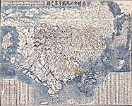
 The first Buddhist world map printed in Japan and the prototype for all subsequent Buddhist world maps printed in Japan until the late nineteenth century. Made by Zuda Rokashi in 1710.
"Hotan's map was revolutionary in being the first printed Oriental map to introduce detailed Western cartographic information into this traditional Buddhist cosmological view and to attempt to merge the two together into a comprehensible form. Europe is depicted as a series of islands in the upper left of the image, whilst South America is likewise another island in the lower right of the image. Africa is omitted completely. China and Japan are clearly defined in the upper right of the map. The popularity of the map is evidenced by the fact that although the map is dated 1710, it was reissued unchanged in numerous editions through to about 1815, and spawned innumerable copies and derivatives over the next 150 years. A rare and important cartographic work."
©:image: PD; text: (extensive information) www.abemaps.com
tags: #japan #buddhist #map
Conjuring 17th Century Japan

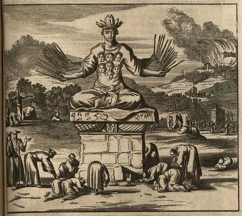
One of the most important books that filled the vacuum of knowledge about Japan in the second half of the 17th century was an extensive volume by the Dutch vicar, missionary and church historian, Arnoldus Montanus. He collaborated with the Amsterdam print-shop of Jacob van Meurs to produce 'Denckwürdige Gesandtschafften der Ost-Indischen Geselschaft in den Vereingten Niederländern an unterschiedliche Keyser von Japan' in 1669. That's obviously the German title and the images above come from its second reprint in 1670. The book was very popular and John Ogilby* pirated an english translation under the title: 'Atlas Japanensis, being Remarkable Addresses by Way of Embassy of the East India Company to the Emperor of Japan Containing a Description of Their Several Territories, Religions, Laws, and Customs, Prodigious Wealth & Georgeous Habits, the Nature of Their Soil, Plants, Beasts, Hills, Rivers & Fountains With the Character of the Ancient & Modern Japanners. Collected Out of Their Several Writings and Journals.', also published in 1670 (it had been released in at least five languages within two years). Read more:
bibliodyssey2lj.livejournal.com
, ,
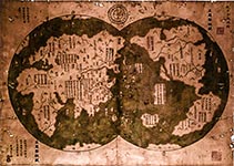
 A controversial Chinese map argued by some to be from 1418 ...
"The Chinese voyage to America theory was popularized by British amateur historian Gavin Menzies in his 2002 boo, entitled "1421: the Year China Discovered America." The controversial, bestselling work claims that Chinese admiral Zheng He reached the Americas more than 70 years prior to Christopher Columbus' famous voyage. ..."
©: www.livescience.com
tags: #1421 #china #discovery #america
ref. # 123 - 1421 China discovered America before Columbus
 A controversial Chinese map argued by some to be from 1418 ...
"The Chinese voyage to America theory was popularized by British amateur historian Gavin Menzies in his 2002 boo, entitled "1421: the Year China Discovered America." The controversial, bestselling work claims that Chinese admiral Zheng He reached the Americas more than 70 years prior to Christopher Columbus' famous voyage. ..."
©: www.livescience.com
tags: #1421 #china #discovery #america
124 -Grand Tartar Cham or Emperor of China
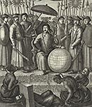
 Title: '[Frontispiece] An embassy sent by the East-India Company, of the United Provinces to the Grand Tartar Cham or Emperor of China delivered at Pekin by Peter de Goyer and Jacob de Keyzer A 1655'
"The German 1666 title page (after the Dutch original) was rendered into English a couple of years later as: 'An embassy from the East-India Company of the United Provinces, to the G, nd Tartar Cham, emperor of China: delivered by their excellencies Peter de Goyer and Jacob de Keyzer, at his imperial city of Peking wherein the cities, towns, villages, ports, rivers, &c. in their passages from Canton to Peking are ingeniously described by John Nieuhoff; also an epistle of Father John Adams, their antagonist, concerning the whole negotiation; with an appendix of several remarks taken out of Father Athanasius Kircher; Englished and set forth with their several sculptures by John Ogilby 1673'"
The German version of the drawing (in the book 'SAIL -in 80 pages around the World') is quite different from the English gravure as seen here! Universitätsbibliothek Heidelberg
©: "Based on the date of publication, this material is presumed to be in the public domain.| For information on re-use see
tags: #china #east india company #OIC #universitaetsbibliothek heidelberg

