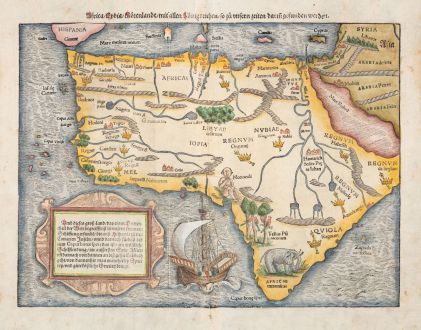
EAST COAST AFRICA
ref. # 035 East Coast of Africa -'Afrique selon les Relations les plus Nouvelles'
Map: 'Afrique selon les Relations les plus Nouvelles', dressée et dediée Par le. P. CORONELLI (1689)."The East African seaboard, stretching some 1,250 miles from Somalia in the north to Madagascar and Mozambique in the south, was a culturally dynamic region throughout the historical period. Traditionally known as the Swahili Coast, the maritime zone extends a mere nine miles inland.
The Swahili cultural identity originated during the middle of the first millennium A.D., following the consolidation of earlier farming and metal-using Bantu-speaking communities along the coast and the emergence of a distinctive maritime orientation.
Previous research has produced evidence of long distancce exchange networks that linked parts of this coast with the Classical world by at least the B.C./A.D. transition. By the end of the first millennium A.D., this trade had grown to include China, India and the Arabian Peninsula.
About this time, a series of autonomous coastal towns were established, and by the 13th century, their functions included controlling and managing trade and communications along the eastern seaboard of Africa. European influence arrived in the 16th century when the Portuguese established fortified port towns along the coast. The Omani Arabs arrived in the late seventeenth century and dominated the coastline for 150 years."
text: www.pbs.org
©: image: Barry Lawrence Ruderman Antique Maps
See also: Wikipedia: Mao Kun map, generally referred to by Chinese people as Zheng He's Navigation Map is a set of navigation charts published in the Ming dynasty military treatise Wubei Zhi.
tags: #maps #East Africa


